I. The Enduring Mystery of 88888: America’s Most Famous Fictional ZIP Code
In the vast and meticulously organized world of the United States Postal Service (USPS), where nearly 42,000 ZIP codes define the nation’s geography with numerical precision, one code stands apart: 88888. It is a number that exists in a state of contradiction, a paradox that lives at the intersection of federal bureaucracy, holiday folklore, and the strange quirks of our digital world. On one hand, many sources confidently label ZIP code 88888 as “purely fictional,” a fun but non-operational concept associated with Christmas cheer. On the other hand, it is an officially sanctioned address used by the USPS itself, a critical component of a century-old national charity program.
This code is a cultural touchstone, instantly recognizable to millions of Americans as the home of Santa Claus, a beloved myth that transcends a simple string of digits. Yet, it is also a data anomaly, a ghost in the machine that appears in unexpected places. It surfaces in real estate databases, advertising “homes for sale” in a location that doesn’t physically exist, and is cataloged by data providers as belonging to “Fictional Town, USA” or “North Pole, DC”. This confusion is not a simple matter of “real versus fake.” It is the direct result of a collision between public perception and the technical nuances of a complex data system. The common understanding is that a ZIP code must represent a geographic area—a neighborhood, a town, a collection of streets. The reality, however, is that the USPS system is far more versatile, containing special-purpose, non-geographic codes designed for unique situations. The code 88888 is not fictional; it is a real, functional, “Unique” type ZIP code, and the misunderstanding surrounding it offers a perfect window into the hidden complexities of the system.
This report will unravel the complete story of ZIP code 88888. The journey begins with the heartwarming tale of Operation Santa, the official purpose behind the famous address. From there, it will venture into the high-stakes world of real estate to decode the mystery of its phantom listings. Finally, it will use 88888 as a launchpad to explore the profound and often startling ways the entire ZIP code system shapes American life, from demographic research and business strategy to the deep-seated connection between a postal code and a person’s destiny.
II. Santa’s Official Mailbox: The Real Story Behind 123 Elf Road, North Pole, 88888
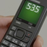
While the number 88888 may seem mythical, its function within the U.S. Postal Service is concrete and deeply rooted in one of the nation’s most cherished holiday traditions. The address Santa Claus, 123 Elf Road, North Pole, 88888 is the official, operational mailing address for the USPS Operation Santa program, a nationwide initiative that connects anonymous donors with children and families in need. The assignment of a unique ZIP code like 88888 is a logistical necessity, allowing the USPS to easily identify and divert all letters intended for this specific program to a central processing workshop where they are prepared for adoption.
A Century of Giving: The History of Operation Santa
The program’s origins trace back over a century to 1912, when Postmaster General Frank Hitchcock formally authorized local postmasters to allow postal employees and citizens to respond to the growing number of letters addressed to Santa Claus. What began as an informal, decentralized act of local kindness evolved as mail volume surged. By the 1940s, the Post Office Department invited charitable organizations and corporations to help manage the influx of letters, expanding the program’s reach and impact.
The evolution of Operation Santa mirrors the broader evolution of communication and privacy concerns in American society. For decades, the program operated on a local, in-person basis. However, in an age increasingly aware of data security, the program underwent a significant modernization. In 2006, the USPS established national policies to protect the safety and privacy of participating children and families. This new framework required volunteers to present identification and stipulated that personal details, such as last names and full addresses, be redacted from the letters before they were shared.
This shift toward structured, secure charity set the stage for the program’s digital transformation. In 2017, the USPS launched a pilot online version of Operation Santa in New York City, allowing adopters to browse and select letters digitally for the first time. The pilot was a success, and the digital platform expanded to more cities in subsequent years before launching nationally in 2019, making the program accessible to more Americans than ever before. This transition from physical letter-viewing at post offices to a centralized online portal reflects the same technological forces that have reshaped commerce, communication, and nearly every other aspect of modern life. The program has also become a cultural phenomenon, featured in television specials with celebrity participants like Hilary Duff and Tony Hawk and serving as the subject of the 2020 documentary
Dear Santa.
How Operation Santa Works Today (A Practical Guide)
The modern, digitized Operation Santa program is a sophisticated operation with clear guidelines for both letter writers and adopters.
For Families and Children: To participate, a letter to Santa must be sent through the U.S. Postal Service with a First-Class Mail stamp. The envelope must be clearly addressed to SANTA CLAUS, 123 ELF ROAD, NORTH POLE 88888. Crucially, the letter must include a full, legible return address on both the letter and the envelope, as this is the only way a gift can be sent. Letters are accepted starting in the fall and must typically be postmarked by early to mid-December to be eligible for adoption. Inside Santa’s U.S. satellite workshop, these letters are opened, reviewed, and all personal information (like last names and addresses) is redacted before they are uploaded to the official website.
For Adopters: Generous individuals or teams can visit the USPSOperationSanta.com website during the holiday season to “adopt” letters. The process involves:
- Creating an Account: Potential adopters must register and verify their identity each year to ensure the safety of the program.
- Browsing Letters: Once registered, users can read the redacted letters online, filtering by state to find requests from specific regions. Letters from the same household are often bundled so that an entire family’s wishes can be fulfilled.
- Adopting and Shopping: After choosing a letter, the adopter purchases gifts to fulfill the child’s wishes. The program encourages sending new items and advises against sending cash or gift cards.
- Shipping from Santa: The adopter takes the boxed gifts to a participating Post Office. Instead of writing the child’s address on the package, they present a unique QR code from their adoption confirmation email. A postal clerk scans the code, which retrieves the confidential shipping information and prints the official label. This system ensures that the gift arrives from “Santa,” maintaining the anonymity of both the child and the donor.
This highly structured, centralized, and secure system is the modern reality of a century-old tradition, all made possible by the simple, non-geographic routing instruction provided by ZIP code 88888.
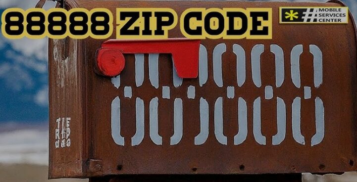
III. The 88888 Real Estate Enigma: Decoding “Homes for Sale” in a Fictional Town
One of the most perplexing aspects of ZIP code 88888 emerges when it is entered into the search bar of a major real estate website. Queries for “88888 homes for sale,” “88888 housing market,” or “Zillow 88888” often return what appear to be legitimate property listings. For instance, Realtor.com has shown results for 88888, indicating a handful of homes for sale with prices ranging from $225,000 to $5.3 million and mentioning the presence of grocery stores, cafes, and restaurants. This naturally leads to confusion: if 88888 is Santa’s address, why are there multi-million dollar homes for sale there? The answer lies not in a secret Arctic metropolis, but in the technical requirements of massive databases and the concept of “placeholder” data.
The Concept of Placeholder Data
Large, complex databases, like those that power national real estate platforms, are built on rigid structures. For a property to be entered into the system, certain data fields are mandatory, and one of the most common required fields is a ZIP code. However, in the real world, data is often incomplete. A real estate developer might want to list lots in a brand-new subdivision where official street addresses and ZIP codes have not yet been assigned by the USPS. To handle this discrepancy, developers and data entry professionals use placeholder data—a validly formatted but functionally inert piece of information used to fill a required field until the correct data is available.
This practice is analogous to the “555” telephone number prefix frequently used in movies and television shows. The 555 prefix is reserved for fictional use to prevent viewers from calling a real person’s phone number. In the same way, a non-geographic, non-functional ZIP code like 88888 can serve as a perfect placeholder. Using it allows a new listing to be entered into the system without the risk of it being associated with a real, but incorrect, geographic location. Evidence of this can be seen on platforms like Zillow, where some new construction listings are explicitly titled “Placeholder” and are associated with a temporary or generic identifier before being updated with a final, accurate address.
Deconstructing the “Listings”
A closer look at the real estate listings for 88888 reveals their non-literal nature. While a platform might show a price range and a list of amenities, it will also contain tell-tale signs of its placeholder status. For example, the same listings often state, “Currently we cannot show market trends in 88888” or “Currently we cannot show schools in 88888”. This is because there is no actual geographic area, no collection of real homes, and therefore no sales data or school district information to analyze. The location is frequently cited as “North Pole, DC,” a playful but clear indication that the listing is not for a physical property in Washington, D.C., but is a data entry linked to the famous fictional address.
The table below deconstructs common search queries for 88888 and explains what the results actually mean.
| Common Search Query | What You See on Real Estate Sites | What It Actually Means |
| “88888 homes for sale” | A small number of properties with prices and photos. | Placeholder entries for new constructions or unlisted properties; not a real location. |
| “88888 housing market” | “Currently we cannot show market trends”. | Confirms no actual market data is associated with this non-geographic code. |
| “88888 property records” | No results or generic, unverified data. | There are no real properties, so no official public property records exist. |
| “Amenities near 88888” | “You can find dozens of grocery stores, and hundreds of cafes”. | This is likely generic or aggregated placeholder text, not a factual representation of amenities. |
The existence of these placeholder listings highlights a fundamental tension of the digital age: the conflict between the need for structured, complete data required for automated systems and the messy, often incomplete nature of real-world information. A real estate platform’s database schema demands a ZIP code for every entry to function correctly. Real-world scenarios, like new construction, create records that don’t yet have one. Rather than reject the incomplete record and create a data bottleneck, the system uses a placeholder like 88888 to satisfy the structural requirement and keep the data flowing through the pipeline. What appears as a “glitch” or a “mystery” to the end-user is, in fact, a pragmatic, systemic solution to a data integrity problem, revealing how the architecture of our digital information systems shapes the world we see online.
Pivoting to Real Value: How to Find Real Estate Data by ZIP Code
While 88888 itself offers no actionable real estate data, understanding its role as a placeholder provides a perfect opportunity to learn how to find legitimate data for any real U.S. ZIP code. Savvy home buyers, investors, and real estate professionals use specific, targeted keywords to access valuable information. Instead of a generic search, they use phrases like:
- “house comps in my neighborhood [zip code]”
- “new home listings [city or county]”
- “foreclosure listings [city or state]”
- “fixer upper homes for sale [city, county, or state]”
- “[zip code] homes for sale”
This data is sourced from various channels, including Multiple Listing Services (MLS) and public records. Major real estate technology companies like Zillow also make a wealth of this information available to the public. Through its Zillow Economic Research division, anyone can access and download datasets that provide real metrics by ZIP code, including median home values, median rent prices, sales volume, and housing inventory levels, with some data going back to the late 1990s. This allows for genuine market analysis, a task impossible for a placeholder like 88888.
IV. The “People” of 88888: A Deep Dive into Demographics, Population, and Safety
Just as with real estate, search queries for the demographics of ZIP code 88888 lead to a statistical void. Data aggregator websites that compile demographic information show that 88888 has a population of 0, a median age of 0, and covers 0 square miles of land. These null values are the clearest possible confirmation that 88888 is not a residential area and has no associated population. It is a unique code assigned to a program, not a place where people live. However, this dead end for 88888 serves as an excellent starting point for a crucial and valuable guide: how to find real demographic and safety data for any legitimate U.S. ZIP code.
Your Ultimate Guide to Finding Demographic Data for Any U.S. ZIP Code
The primary source for authoritative demographic data in the United States is the U.S. Census Bureau. However, accessing this data at the ZIP code level requires understanding a key technical distinction that is crucial for accurate analysis. The Census Bureau does not report data using USPS ZIP codes. Instead, it uses a specially created statistical geography called a
ZIP Code Tabulation Area (ZCTA).
This distinction is necessary because of the fundamental nature of a ZIP code. A USPS ZIP code is not a polygon or a distinct shape on a map; it is a collection of mail delivery routes. These routes can overlap, cross city and county lines, and sometimes have no geographic area at all (for example, a ZIP code for a single building or a military installation). This logistical, line-based structure is perfect for delivering mail efficiently but is incompatible with the needs of statistical reporting, which requires discrete, non-overlapping geographic areas to avoid double-counting people or households.
To solve this, the Census Bureau created ZCTAs. A ZCTA is a geographic area, a polygon on a map, built by aggregating Census blocks. It is designed to approximate the land area covered by one or more USPS ZIP codes. Therefore, any business, researcher, or citizen using “ZIP code data” for demographics from the Census Bureau is almost always, perhaps unknowingly, using ZCTA data. Understanding this difference is a mark of true data literacy.
To find this data, one can use the Census Bureau’s primary data portal, data.census.gov. The process is as follows:
- Navigate to
data.census.gov. - Use the advanced filters and select the “Geography” filter.
- Choose the option “ZIP Code Tabulation Area.” Do not choose “5-digit ZIP Code,” as that option is for economic data (like business patterns), not demographic data.
- Enter the desired five-digit ZCTA number.
- Once the geography is selected, you can browse available tables and datasets for topics such as population totals, age and sex distribution, racial and ethnic composition, household income, poverty status, and housing characteristics.
A Guide to Local Safety and Crime Data
Following the same pattern, a search for the “88888 crime rate” will yield a result of zero, as there are no people or reported incidents. For real communities, finding reliable crime data is a common concern for families, homebuyers, and researchers.
The highest-level source for this information is the Federal Bureau of Investigation (FBI), which collects data from over 18,000 law enforcement agencies across the country through its Uniform Crime Reporting (UCR) Program. The public can access this information through the FBI’s
Crime Data Explorer (CDE). The CDE allows users to find statistics on violent crimes (like murder, robbery, and aggravated assault) and property crimes (like burglary and motor vehicle theft). The data can be explored nationally or filtered down to the state, county, or individual law enforcement agency level.
While the CDE provides an excellent overview, it does not typically offer data at the granular ZIP code level. For that level of detail, one must often turn to local or municipal sources. Many city police departments now maintain their own public-facing crime data dashboards. For example, Washington, D.C., which is the “state” sometimes associated with the fictional North Pole address for 88888, has a “Crime Cards” website that provides interactive maps and charts of offenses within the district. These local resources are often the best way to understand crime trends in a specific neighborhood or ZIP code.
V. Beyond Santa: A Tour of America’s Most Unique and Unusual ZIP Codes
The story of 88888 reveals that not all ZIP codes are created equal. While most correspond to a geographic area, a special category known as Unique ZIP Codes is assigned to single entities—government agencies, large corporations, universities, or even landmark buildings—that receive a very high volume of mail. This system streamlines mail delivery by allowing the USPS to route all mail for that entity directly to a central processing point, bypassing standard street-level sorting. The assignment of a unique ZIP code is not just a logistical tool; it has become a form of branding and a reflection of cultural or institutional significance. An entity with its own ZIP code has, in a sense, reached a threshold of importance that sets it apart. Here is a tour of some of America’s most fascinating unique and notable ZIP codes.
- 12345 (Schenectady, NY): Perhaps the most memorable ZIP code in the country, 12345 is assigned to the General Electric Company in Schenectady, New York. The city is nicknamed “The Electric City” because it was the original headquarters of GE, and this easily remembered code serves as a permanent nod to that history and a powerful piece of corporate branding.
- 20500 (Washington, D.C.): This is the ZIP code for one of the most famous addresses in the world: The White House. This code perfectly illustrates the hyper-specific nature of the ZIP+4 system. While 20500 gets mail to the complex, mail addressed to 20500-0001 goes directly to the President of the United States, and mail addressed to 20500-0002 is routed to the First Lady.
- 20252 (Washington, D.C.): This ZIP code belongs to a single, non-human individual: Smokey Bear. At the height of his popularity as an advertising icon for the U.S. Forest Service, Smokey received so much fan mail that the Post Office granted him his own ZIP code to handle the volume. The code was retired in 1993 but later reinstated by popular demand as children continue to send him letters.
- 90210 (Beverly Hills, CA): Arguably the most culturally famous ZIP code in the world, 90210 became an international symbol of wealth, glamour, and drama thanks to the popular 1990s television show Beverly Hills, 90210. The code is more widely recognized than many of the streets within its boundaries and consistently appears on lists of the nation’s most expensive real estate markets.
- 90090 (Los Angeles, CA): In 2009, Dodger Stadium became the first sports venue in the United States to be assigned its own unique ZIP code. This recognized the massive volume of mail associated with a major league baseball team and its large stadium operations.
- 10118 (New York, NY): This ZIP code belongs to a single building: the Empire State Building. As a world-famous landmark containing offices for hundreds of different businesses, the skyscraper receives a volume of mail sufficient to warrant its own dedicated ZIP code, simplifying delivery in one of the densest urban environments on the planet.
- 00501 (Holtsville, NY): Holding the distinction of being the lowest-numbered ZIP code in use, 00501 is assigned to the Internal Revenue Service (IRS) submission processing center in Holtsville, New York. Like other unique codes for government agencies, it allows for the efficient bulk processing of millions of pieces of mail without needing detailed street addresses.
These examples show that the ZIP code system contains a hidden layer of special designations that reflect the unique commercial, cultural, and political landscape of the United States.
VI. Your ZIP Code, Your Destiny? The Surprising Link Between Postal Codes and Prosperity
A provocative question has gained traction among sociologists, economists, and public health officials in recent years: “Is your ZIP code more important than your genetic code?”. A growing body of research suggests that the answer, in many respects, is yes. The five digits that direct mail to a doorstep have become one of the most powerful predictors of a person’s health, wealth, and opportunity in modern America. The ZIP code system, an invention of pure logistical convenience, has unintentionally become a stark reflection—and in some ways, a driver—of deep socioeconomic divides.
The Socioeconomic Power of a ZIP Code
Studies have consistently shown a startling correlation between a person’s location and their life outcomes. Research from institutions like the Brookings Institution and analyses of public health data reveal that ZIP codes are strongly linked to life expectancy, rates of chronic disease, and economic mobility. The differences can be dramatic. For example, a study in St. Louis found that a child born in the 63106 ZIP code had a life expectancy of 67 years, while a child born just a few miles away in the 63105 ZIP code had a life expectancy of 85 years—an 18-year gap determined largely by neighborhood. This disparity is not an outlier; it is a pattern repeated in metropolitan areas across the country.
Groundbreaking research led by economist Raj Chetty at Harvard University has demonstrated that this link is not merely a correlation but has a causal component. Using massive administrative datasets, his team showed that a child’s chances of climbing the income ladder vary enormously from one city to another. Critically, the research found that when a family moves from a low-opportunity neighborhood to a high-opportunity one, their children’s future earnings significantly increase, and the younger the child is at the time of the move, the greater the benefit. This suggests that the resources, social networks, school quality, and safety of a neighborhood have a direct, tangible impact on a child’s life trajectory.
The Economic Divide and Its Self-Reinforcing Nature
The ZIP code was initially created for the sole purpose of sorting mail more efficiently. However, other organizations and businesses quickly realized its immense value for organizing data by geography. The U.S. Census Bureau uses it (via ZCTAs) to report statistics, and industries like insurance, real estate, and marketing adopted it as a primary tool for market segmentation. This commercial adoption, while logical, created a powerful feedback loop that helps perpetuate geographic inequality.
When an insurance company identifies a ZIP code as “high-risk,” premiums rise for everyone in that area. When a bank “redlines” a ZIP code, access to credit and investment dries up. When realtors and marketers identify a ZIP code as “desirable,” property values and rents skyrocket, often pricing out long-time residents and concentrating wealth. Over time, this data-driven sorting mechanism contributes to the geographic concentration of both wealth and poverty. The ZIP code doesn’t just
describe inequality; it becomes a tool that helps reinforce it.
This economic chasm is most vividly illustrated in the real estate market. Certain ZIP codes have become synonymous with extreme wealth, commanding home prices that are orders of magnitude higher than the national average. The table below, using 2022 data, highlights some of the most expensive ZIP codes in the United States.
Source: Data compiled from PropertyShark 2022 rankings as cited in news reports.
These figures demonstrate the extreme concentration of wealth in a handful of elite enclaves. The fact that a ZIP code can serve as such a reliable proxy for wealth underscores its power as a socioeconomic indicator. It reveals how a neutral, logistical tool has been co-opted by market forces to become an active agent in the geographic sorting of modern America.
VII. The Business of Place: How Companies Leverage ZIP Code Data for Profit
Long before the ZIP code became a subject of sociological study, the business world recognized its immense potential. The simple five-digit code, designed to move mail, provided something revolutionary: a universal, standardized system for organizing the entire United States population geographically. This innovation became a support structure for entire industries and, according to an IBM analysis, adds nearly $10 billion in value to the economy annually through its non-postal uses alone. Today, businesses leverage ZIP code data as a cornerstone of their intelligence, marketing, and logistics strategies.
ZIP Codes as a Business Intelligence Tool
At its core, the ZIP code allows businesses to perform sophisticated market segmentation. By analyzing demographic data at the ZIP code level—such as age, income, education, and household size—a company can identify and target specific consumer profiles. A national retail chain can use this data to differentiate its stock, emphasizing products for affluent seniors in one ZIP code and products for young, working-class families in another. This allows for more efficient inventory management and marketing that resonates with the local population.
This geographic data is also fundamental to logistics and supply chain optimization. Companies use ZIP code analysis to plan more efficient delivery routes, determine optimal locations for warehouses and distribution centers, and establish variable shipping charges based on distance. For service-based businesses, from pizza delivery to plumbing, ZIP code maps are essential for defining service territories and providing accurate time and cost estimates to customers.
Hyperlocal Targeting and Digital Marketing
In the digital age, the ZIP code has become a primary tool for hyperlocal advertising. On platforms like Google Ads and Facebook, businesses can target their ads to users within specific ZIP codes, ensuring that their marketing budget is spent on reaching the most relevant local customers. This granular approach has proven to be highly effective. One analysis showed that shifting from a city-level to a ZIP code-based advertising strategy resulted in a 212% increase in conversion rates and a nearly 60% decrease in the cost per conversion.
This strategy is often powered by the use of ZIP code modifiers in search engine optimization (SEO) and pay-per-click (PPC) campaigns. A business might bid on keywords like “+dentist +80504” to capture the highly focused search traffic of someone looking for a dentist in that specific area. This tactic relies on
long-tail keywords, which are longer, more specific search phrases (e.g., “3-bedroom homes for sale in 90210”) that typically have lower search volume but much higher conversion rates. A user searching with such specificity is often much closer to making a purchase decision, making them a highly valuable lead.
This intense focus on local markets has created a data-driven arms race for dominance. The businesses that can most effectively analyze and act on ZIP code-level data gain a significant competitive advantage. A company might use ZIP code mapping to identify an underserved affluent area and establish a first-mover advantage. As competitors inevitably follow, the battle moves to a more granular level, with businesses using demographic overlays and hyper-targeted digital ads to defend and expand their market share. In this environment, ZIP code data is not just a static resource; it is the battlefield on which modern local commerce is fought.
Accessing the Data
Businesses access this crucial data through a variety of channels. Public sources like the U.S. Census Bureau’s ZIP Code Business Patterns dataset provide free, high-level information on the number of establishments, employment figures, and payroll by ZIP code. For more dynamic and integrated solutions, companies turn to a robust market of third-party data providers. These providers offer Application Programming Interfaces (APIs) that allow businesses to feed real-time, granular ZIP code data directly into their own software for applications like marketing automation, logistics planning, and customer relationship management (CRM).
VIII. Conclusion: Deconstructing 88888
The journey into the world of ZIP code 88888 begins with a simple question of authenticity and ends with a profound understanding of the codes that define modern America. This single five-digit number embodies a fascinating duality. It is, at once, the real and functional address for Operation Santa, a century-old USPS program that channels the nation’s holiday generosity. Simultaneously, it is a phantom, a placeholder that haunts the digital ether of real estate databases, a ghost in the machine born from the pragmatic needs of data management.
The story of 88888 serves as a microcosm of the entire Zone Improvement Plan. It reveals how a system created in 1963 for a purely logistical purpose—the efficient sorting of physical mail—has evolved into something far more powerful and complex. The ZIP code has become a cornerstone of our digital economy, a fundamental tool for business intelligence, market segmentation, and hyperlocal advertising that generates billions in economic value. It has also become a primary lens through which we view our society, offering a stark, numerical reflection of our deepest socioeconomic divides.
Ultimately, a ZIP code is never just a number. It is a story of cultural traditions like writing to Santa. It is a data point that can determine business strategy and insurance rates. It is a marketing tool that connects customers with local services. And, for better or for worse, it is a powerful symbol of place that can reflect, and even reinforce, the boundaries of opportunity in the 21st century.